Organization
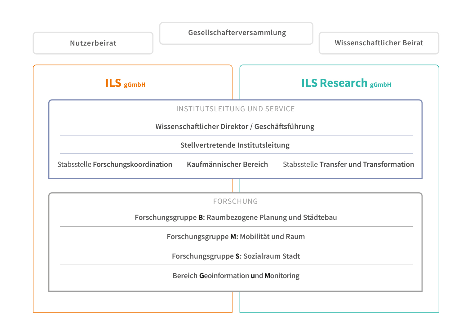
Managing Director of Research
The Managing Director of Research is responsible for the Institute’s activities, within the sense of German commercial law. He organises the Institute’s work in substantive terms on the basis of the criteria of scientific excellence.
Deputy institute management
The deputy institute management supports the scientific managing director. It consists of four authorized signatories.
Commercial Department and Services
The Commercial Department and Services encompasses organisation, contract management, Human Resources, internal and external accounting, IT, procurement, general administration and the ILS library.
Research coordination
The research coordination unit is mainly responsible for research planning and quality assurance in close consultation to the management board. Research coordination unit also includes the Institute’s library, which is open to external visitors and ILS employees.
Transfer and Transformation
The unit Transfer and Transformation includes the areas of knowledge transfer and the coordination of transformative research at the ILS. It prepares current research results and communicates them to various target groups.
Knowledge transfer on the basis of our transfer strategy covers press and public relations with all print products, events, our website and social media. With new transdisciplinary research formats, we enter into a close exchange with the practice for the transformation and solution of social problems. The department also includes design/layout and printing as well as event management.
Forschungsorganisation im ILS
Die Forschung im ILS wird in drei Forschungsgruppen und dem Bereich Geoinformation und Monitoring realisiert. Diese sind interdisziplinär und temporär angelegt. Zudem wird eine enge Vernetzung der Forschungsgruppen untereinander durch einen forschungsgruppenübergreifenden, an den definierten Forschungsthemen ausgerichteten Personaleinsatz sowie durch die regelmäßig stattfindenden Forschungskonferenzen erreicht.
- Raumbezogene Planung und Städtebau
Leitung: Prof. Dr.-Ing. Thomas Weith
- Mobilität und Raum
Leitung: Dr. Thomas Klinger
- Sozialraum Stadt
Leitung: Dr. Sabine Weck
Geoinformation and Monitoring
The „Geoinformation and Monitoring“ unit provides services for all research groups. These services are crucial to the research work carried out by the Institute’s geo-data processing facilities, under which all data of relevance to the Institute’s research groups are processed and formatted. Its cartography facilities are used for producing high-quality visual material (maps, diagrams, etc.) for research projects, publications and presentations, and also digital media. The objective of ILS „Geoinformation and Monitoring“ is to develop and implement concepts for observing small-scale phenomena and processes in an urban context.

